Outback South Australia

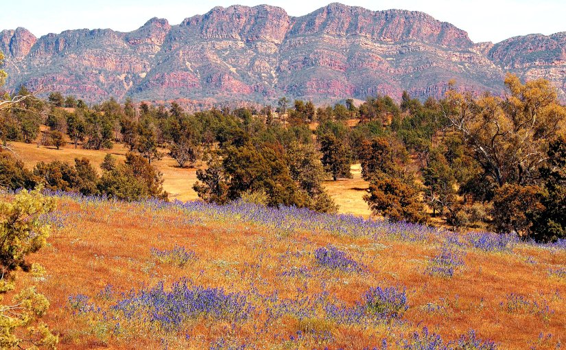
A visit to the Flinders Ranges in outback South Australia is one of my favourite camping trips; an opportunity to enjoy the solitude of Australia’s haunting and ageless landscape, distinct flora and fauna, bushwalks, ancient rock art and more. One visit is not enough, as the Ranges cover a vast area, stretching over 400 kilometres.

On the way from home near Melbourne, I stay at campsites on the banks of the Murray River, at quaint and quiet country towns, or in some of South Australia’s prime wine regions like the Barossa Valley and Clare Valley. Tasting wines before camping in the desert has a certain piquancy.

P9070270.JPG

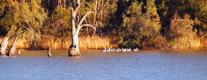
The tranquility of the Murray River is occasionally broken by a flotilla of pelicans gliding  by the campsite, or a passing houseboat.

Lyrup

Burra is an appealing South Australian country town close to the Ranges. Typically, it has grand buildings, a characterful pub, and fine streetscapes, a testament to a more prosperous past; in its case, copper mining.

OLYMPUS DIGITAL CAMERA

The Burra Hotel

Another classic country pub at Peterborough.

OLYMPUS DIGITAL CAMERA

Bush camping at Wilpena Pound in the Flinders Ranges. The billy is boiling on the open fire while the solar panel charges the battery to power the portable refrigerator and lights.

OLYMPUS DIGITAL CAMERA

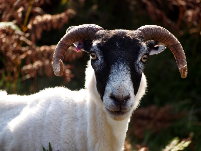
Emus wander through the camp, at home in an arid environment.

OLYMPUS DIGITAL CAMERA

OLYMPUS DIGITAL CAMERA

Red gums line the creek beds waiting for infrequent rains to flood the watercourse.

OLYMPUS DIGITAL CAMERA

A walk or a drive provides these views.

OLYMPUS DIGITAL CAMERA

OLYMPUS DIGITAL CAMERA

OLYMPUS DIGITAL CAMERA

Ruined stone houses are common around the Flinders Ranges. European settlers established farms in the nineteenth century and misunderstood the Outback climate, believing that a good season or two was typical. Ultimately,  the usual drought-like weather conditions prevailed and within a generation, most small settlers were ruined. A tragedy for them, but worse for the Aboriginal people who were displaced by the settlers, after living in the area for tens of thousands of years.

OLYMPUS DIGITAL CAMERA

A Walk on the Isle of Skye: Tragedy, Scenery, Legends, Sheep, and the Highland Clearances

I walked to Boreraig in late August 2017. Boreraig was a Highland crofting village until its inhabitants were forcibly evicted in 1854. The walk provides an opportunity to enjoy the Isle of Skye’s unique scenery, as well as to reflect on the Highland Clearances, and the continuing widespread involuntary displacement of people around the world.

OLYMPUS DIGITAL CAMERA

OLYMPUS DIGITAL CAMERA

The walk commences at the ruin of Cill Chriosd (Christ’s Church in Gaelic) once the main parish church on Skye. Here, the church ruins and graveyard at the left stand below Skye’s imposing Cuillan mountains, with the ruined wall of the Suardal marble cutting and polishing works in the foreground.

Next, it’s a lengthy and steady climb.

OLYMPUS DIGITAL CAMERA

OLYMPUS DIGITAL CAMERA

OLYMPUS DIGITAL CAMERA

It’s a long way to fall from the crest of the hill before the descent into Boreraig.

OLYMPUS DIGITAL CAMERA

Walking or mountain biking are the only options to reach Boreraig by land. I saw only one other couple on my walk. An old stone fence from the village can be seen beyond the cyclists.

About 120 people lived in Borereig’s 22 houses before their forced eviction. Once a beautiful setting for a village, now it’s sombre, eerie and forlorn.

OLYMPUS DIGITAL CAMERA

Stone fences snaking into the distance, and piles of overgrown rocks where houses once stood, are a lonely reminder that a community once existed here.

OLYMPUS DIGITAL CAMERA

OLYMPUS DIGITAL CAMERA

OLYMPUS DIGITAL CAMERA

The return walk offers more of Skye’s ever-changing light and views.

OLYMPUS DIGITAL CAMERA

OLYMPUS DIGITAL CAMERA

On the right above is Beinn na Caillich, one of the Red Cuillan. Local legend claims that the grave of a Norwegian princess from the Viking era is located on the summit where she was laid to rest so that she could forever face the land of her birth and feel its winds.

If you stay on Skye for a while, it’s easy to believe in legends.

OLYMPUS DIGITAL CAMERA

In many cases, sheep replaced people in the Highland Clearances as they offered more money to the landowners.

I’ve written more about Skye here:

https://wordpress.com/post/nomadicpaths.wordpress.com/5477

Walk details

  • Distance: a return walk of 10.2 km from Cill Chriosd on the Broadford to Elgol road. A longer walk includes visiting another Clearance village – Suisinish.
  • Terrain: a steady climb on well defined paths and tracks that are sometimes boggy, and often uneven, followed by a gentle descent into Boreraig. An early part of the walk follows the old ‘Marble Line’, the rail line that was used to move marble down to the Broadford jetty in the late 18th and early 19th centuries. The marble is claimed to be better than Italy’s famous marble from Carrara.
  • Total Ascent: 353m (1158ft)
  • Rating: Superb

http://www.go4awalk.com/walks/walk-search/walk.php?walk=h149

The Clearances

The Highland Clearances were a disaster for Scottish Gaelic culture. Like all major historical events, they are complex. The Laird of Boreraig, Lord McDonald of Skye, claimed that the crofters of Boreraig had to move “because they (the people) were too far from Church.” This was not the real reason for their eviction. Lord McDonald was close to bankruptcy at the time. In an attempt to reverse the debts, the administrators of the McDonald estate cleared Boreraig  and other villages and replaced the people with sheep, because sheep provided bigger profits.

More reading

This site has a brief history of Skye:

http://www.scottishaccommodationindex.com/isleofskyepics.htm

http://www.electricscotland.com/history/clearances/29.htm

http://www.blaven.com/sevenmiles.aspx

http://www.scotsman.com/sport/boreraig-and-suisnish-1-1393025

https://en.wikipedia.org/wiki/Boreraig

https://canmore.org.uk/site/11562/skye-boreraig